This story originally appeared in the June 2024 edition of Town&Gown magazine.
In the chaotic times of the 1760s, many settlers attempted to forge a homestead from the isolated frontier in the heart of the Pennsylvania wilderness. Decades before the iron boom of the 19th century, future Revolutionary War figure James Potter blazed a trail through Native American lands, proclaiming he’d “discovered an empire.” The years that followed highlight one of America’s great land grabs, which quite literally carved out the communities of today’s Centre County.
The land rush followed a time of limited westward mobility. The British Empire, in the wake of the French and Indian War, attempted to prevent westward expansion into the American Midwest. Various treaties aimed to quell violence between Native Peoples and settlers on the frontier boundaries, but the land that would become Centre County hadn’t begun to be settled en masse until after Captain Potter’s journey and initial land warrants, created between 1759 and 1763. Over the next three decades, the villages of Centre County would begin to take shape.
The first major land speculator in Centre County was Reuben Haines, today immortalized by the township bearing his name. Haines was a brewer by trade, had a keen interest in the agricultural and natural sciences, and dabbled in land speculation, as was common among the Philadelphia elite. At the opportunity arose to purchase land in the Pennsylvania wilderness following the Potter expedition, Haines accepted the risk and moved to purchase large tracts of land beginning in 1766. He purchased hundreds of acres spanning from Woodward to Boalsburg.
Although it’s unclear if Haines personally set foot on his vast territory, he spent considerable sums to improve it. His greatest contribution to Centre County came in the form of the county’s first road. Initially plotted from Old Fort through the Penns Valley narrows and into Woodward along modern-day state Route 45, Haines’ road would connect the earliest settlements of Centre County to the East, allowing for rapid growth and immigration into the area.
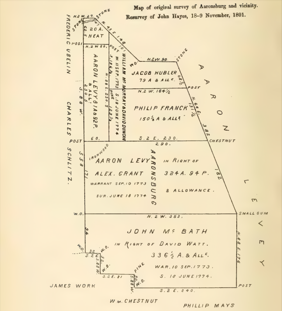
Following the surveying of land in the geographic center of the state, the area was primed for communities to emerge. The first such community, Aaronsburg, was plotted in 1786 by Aaron Levy, a well-known Jewish merchant. Levy was born in Amsterdam and immigrated to the colonies, eventually settling in the town of Northumberland. Although not the biggest land speculator in the state, Levy would, at various times, own more than a half-million acres across Pennsylvania.

One tract, over 300 acres in the newly surveyed “Penns Valley,” would become the site for Levy’s ambitious project, Aaronsburg. According to Levy’s plan, Aaronsburg would be divided into 612 rectangular plots, each sixty feet by 230. Streets and alleys were created in between, with the main north-south street named Rachel’s Way, after his wife. It is widely believed Levy hoped this efficiently designed village would be selected as a future county seat, but that would never come to pass. Interestingly, as most of the settlers to Aaronsburg were German immigrants, a large lot was created for the formation of a Lutheran church. In an act of astounding religious tolerance for the time, Levy gifted the church with an inscribed pewter communion set.
Different motivations attracted Abraham Elder to the Centre County wilderness. In 1784, Elder personally traveled to a tract near present-day Stormstown, likely to prospect for a future homestead. At the site, all he found was an old hunter’s cabin, several Native American and game trails, and endless miles of unbroken wilderness. Over the next several months alone in the wilds, Elder would carve out his plot, planting a small amount of turnips and wheat for harvesting when he returned with his family, clearing the forest, and improving the small cabin.
Having explored the surrounding plots, Elder convinced his brother David to take up residence nearby upon his return to the homestead with his family. Following the building of a large log cabin, Elder would add a saw mill and distillery, purchase land near Port Matilda for a grist mill, build a tavern, plot a roadway over the ridge into the Bald Eagle Valley, and establish a Presbyterian church. At the height of his industry in Halfmoon Township, Elder would replace his log cabin with a stone mansion, which still stands today.
Centre County was officially incorporated in 1800, but its roots reach back to a time of wilderness and frontier on the edge of European civilization and Native lands. Whether carved up by wealthy land speculators, by idealistic builders, or by industrious homesteaders, the landscape was tamed by Centre County’s founders, paving the way for rapid growth in the iron boom of the 1800s. T&G
Local Historia is a passion for local history, community, and preservation. Its mission is to connect you with local history through engaging content and walking tours. Local Historia is owned by public historians Matt Maris and Dustin Elder, who co-author this column. For more, visit localhistoria.com.
Sources:
“Aaronsburg Historical Marker.” Explorepahistory.Com, explorepahistory.com/~expa/hmarker.php?markerId=1-A-29. Accessed 24 Apr. 2024.
Baillie, W. M. “Levy’s Mills.” Columbia County Historical and Genealogical Society, colcohist-gensoc.org/. Accessed 25 Apr. 2024. Linn, John Blair. History of Centre and Clinton Counties, Pennsylvania. Heritage Books, 2007.


